History of the Christopher B. Smith Preserve
I. Ancient Florida
The land we call "Florida" has had a very long geologic history that began about 530 million years ago. At that time, volcanic eruptions along northwest Africa created new land that would become Florida. Over time as a result of plate tectonics, the land has moved to its present location.
II. Origin of the Sand
Hundreds of millions of years ago, sand (made mostly of silicon dioxide) began eroding from the Appalachian Mountains.
Fifteen million years ago, southwest Florida was part of the continental shelf at the bottom of a shallow sea. Rivers transported sand from the eroded Appalachians to the sea and the sand was distributed by ocean currents.
During the last ice age, sea level dropped and the sea floor was exposed. Today, a 60 cm (two feet) thick sand deposit makes up the upper sediments in the Christopher B. Smith Preserve.
III. Native Americans
Early Paleo-Indians were living in Southwest Florida about 10,000 years ago. They and the more recent Archaic Indians and Calusa Indians possibly used the land where the Smith Preserve is today for encampments and for hunting game. Isolated shell tools dating from the Calusa culture have been found at the Smith Preserve by Ian Bartoszek, Conservancy of Southwest Florida biologist, and others.
Above are the remains of two hammers and a scrapping tool. The hammer on the left is made from the shell of Busycon contrarium (Lightening Whelk) and the one on the right from Pleuroploca gigantea (Horse Conch). The handles for the hammers would have been sturdy branches placed through the holes in the shells. The scrapping tool is a piece of broken Mercenaria campechiensis (Southern Quahog).
IV. 1860s to 1960s
White settlers probably visited the Naples area in the mid to late 1860s. In 1876, the first permanent residents arrived. By 1880, there was a seasonal population of 80 people living in the town. In 1886, Naples property was surveyed and in 1887, it was platted.
In the late 1920s, roads and railroads reached Naples. By 1930, there were 390 people living in Naples year round. By 1950, that number had tripled. Today there are over 21,000 people living in the city of Naples.
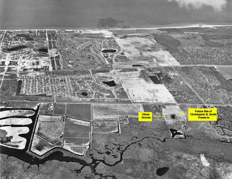
In the 1950s and 1960s, the area where the Smith Preserve is today was a citrus grove. The map below is oriented facing west to the Gulf of Mexico. Note the citrus grove on land that will become the site of the Christopher B. Smith Preserve at the Conservancy of Southwest Florida Nature Center. The pond in the middle of the grove was probably used for irrigation.
After the grove was abandoned, the area evolved into a xeric scrub and upland habitat with an overgrown pond and many exotic plants and animals.
1981 to Present
In 1981, the Conservancy of Southwest Florida built the "Naples Nature Center" on land east of what would later become the Christopher B. Smith Preserve. The 1995 Google Earth map below shows the location of the Conservancy of Southwest Florida, and outlined in yellow, the future Smith Preserve to its west. Note the citrus trees and overgrown pond.
In 2005, with the help of supporters to the "Saving Southwest Florida" campaign, the Conservancy of Southwest Florida purchased the property which became a gopher tortoise preserve named the Christopher B. Smith Preserve.
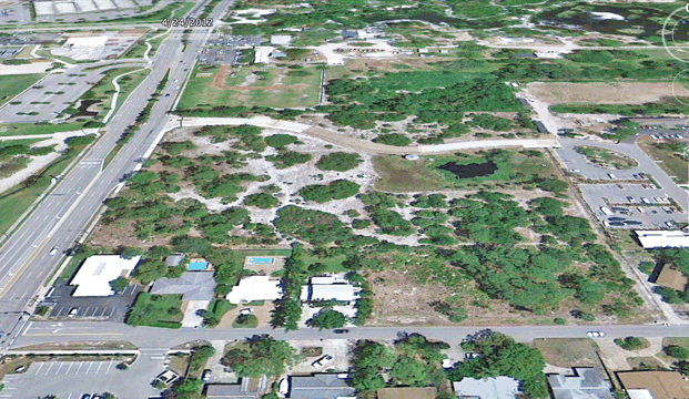
The 2007 Google Earth map below shows the area before changes were made to the property.
In 2008, the Science Division of the Conservancy of Southwest Florida developed a project plan for, and began conducting research on, the gopher tortoises inhabiting the area. For the project plan, click here. For a description of the research procedures and research photographs, click here.
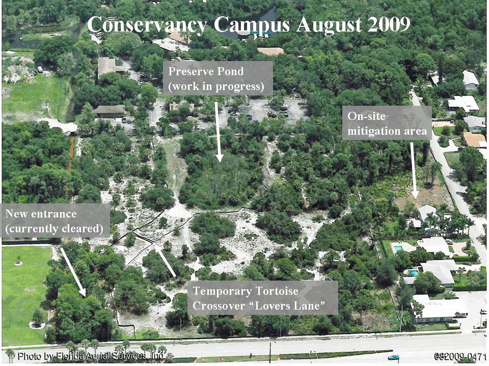
In 2009, plans below show work in progress. This aerial photograph was taken by Florida Aerial Services, Inc. and shows a channel through the roadway under construction labeled "Temporary Tortoise Crossover 'Lovers Lane'". This channel allowed tortoises access between the southern and northern scrub areas. A note on the plans indicates that work is in progress to clear exotic vegetation from the pond.
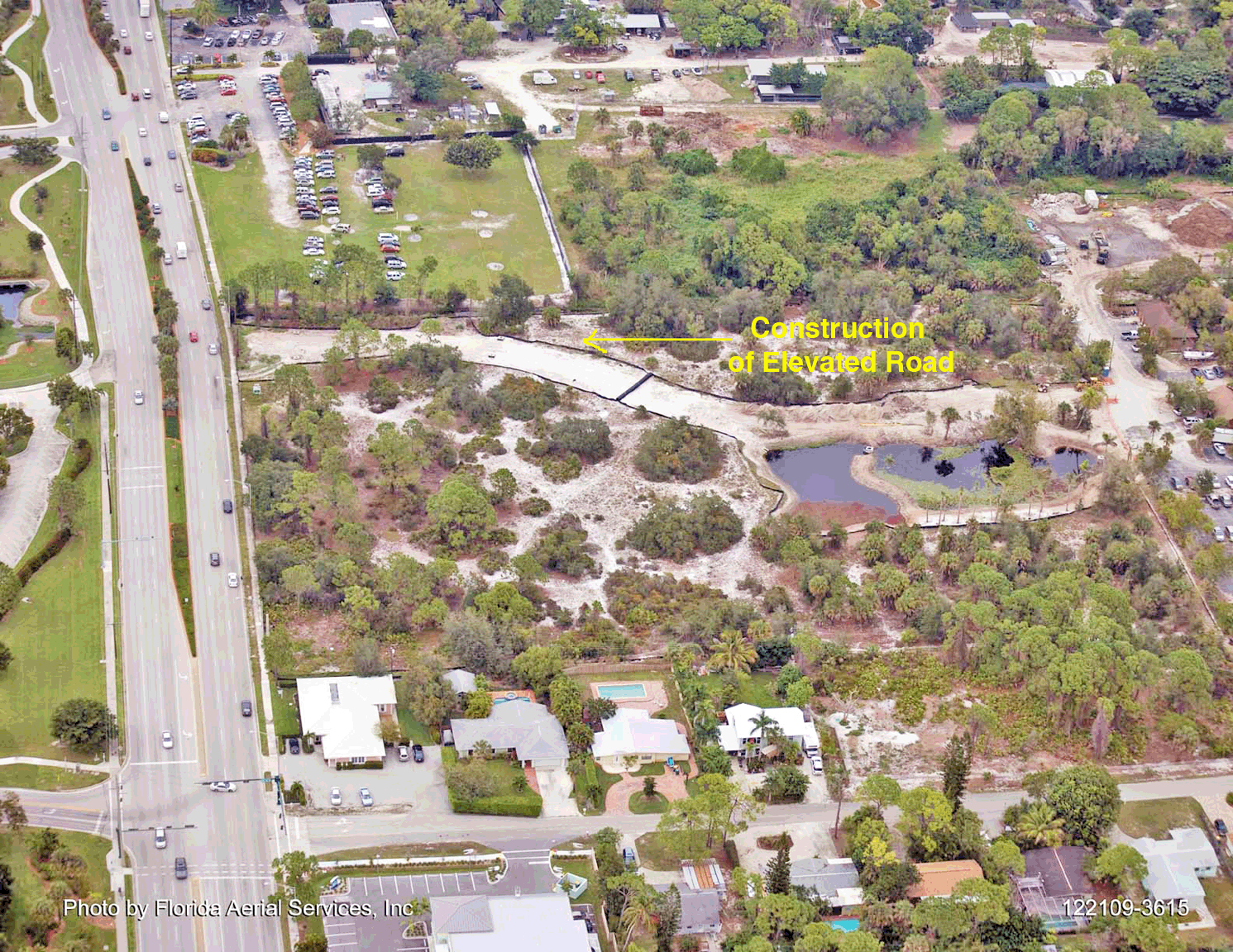
The 2010 aerial photograph below, also taken by Florida Aerial Services, Inc. shows progress has been made on construction of the elevated road (Smith Preserve Way) and on exotic removal from the pond.
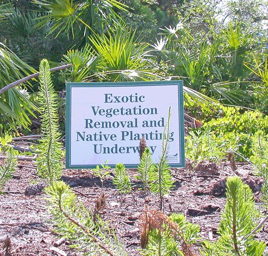
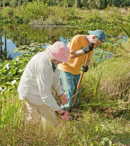
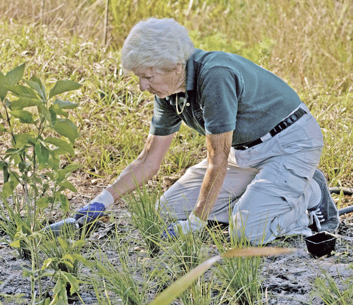
By 2012, the pond had been converted to a filter marsh, most of the exotic vegetation had been removed, and Smith Preserve Way had been completed to allow safe passage for animals. Below are photographs that show removal of exotic vegetation and planting of native vegetation by Conservancy of Southwest Florida horticulture volunteers.
Photograph one above: courtesy of Ian Bartoszek, Conservancy of Southwest Florida biologist; fourth photograph courtesy of Roz Katz, Conservancy of Southwest Florida volunteer.
Today, a variety of citrus trees still remain and a gopher tortoise population has become well-established. Conservancy of Southwest Florida science staff and science volunteers continue removing exotic invasive species and planting native vegetation.
The 2012 Google Earth Image above is facing North, with Goodlette-Frank Road bordering the western edge of the Smith Preserve.