1790 Maps Showing Where both Ulrich Steelys (with variant spellings) settled in Pennsylvania.
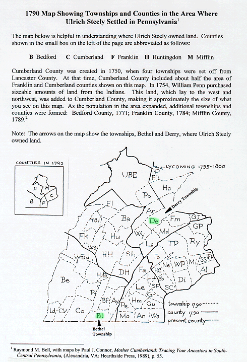
The first map below shows in green, Derry Township in Mifflin County, where Ulrich Steely( #185), father of Gabriel Steely (#93) had land, and Bethel Township in Bedford County where the other Ulrich, often confused with the father of Gabriel, owned land. (Credit goes to Robert Steely for locating and explaining the importance of this map.)
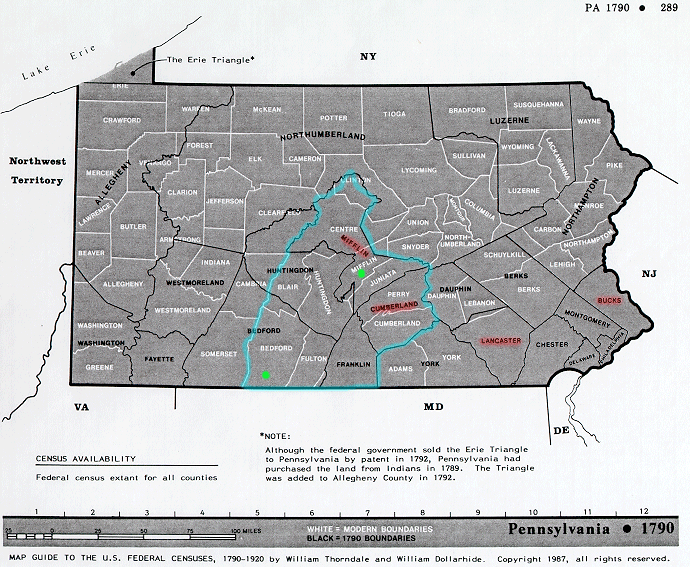
The map below shows the counties in red where Ulrichs (with variant spellings) had documents recorded within the state of Pennsylvania, referenced in the Chart describing Ulrich Steely. Green circles represent the locations in the map shown above where Ulrichs (with variant spellings) owned land. The blue line outlines those counties represented on the map shown above. Note that the map below is dated 1790 and county boundaries had changed throughout the time (1737-1790) when documents were recorded for Ulrich Steely (with variant spelling). (Credit goes to Robert Steely for locating this map.) [Note: on this map Mifflin and Cumberland were the Counties where Ulrich, father of Gabriel, owned land. Lancaster and Bucks are where the other Ulrich owned land.]
Contact person for this website is Susan Snyder: susanleachsnyder@gmail.com